
Every driver knows the familiar ritual of municipal roadwork. A crew closes two lanes of traffic, spends hundreds of thousands of dollars laying down pristine, jet-black asphalt, and leaves behind a surface smooth enough for a bowling alley. Then, eighteen months later, the exact same stretch develops hairline fractures, dips into a rut, and ultimately collapses into a tire-shredding sinkhole.
The public blames the road crews, while municipal engineers blame budget cycles. In reality, both are victims of a shared optical illusion: evaluating civil infrastructure health solely by its surface.
A pristine road surface can easily conceal an active geological crisis brewing three feet below the pavement. By the time ground displacement, sediment erosion, or drainage failure becomes visible to human inspectors, the damage is already structural, and the repair bill has multiplied by an order of magnitude. Civil engineering has spent decades relying on visual observations and post-hoc patching, letting symptoms dictate treatment.
That reactive paradigm is finally running out of road.
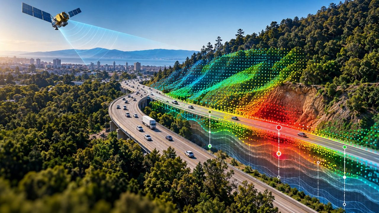
Today, Dynamic Infrastructure, an Engineering AI platform that serves as a system of record for critical civil assets, unveiled an orbital risk prediction service designed to see what ground inspections miss. By fusing synthetic aperture satellite radar with historical engineering records, localized traffic modeling, and machine learning, the platform can detect microscopic ground shifts and standing stormwater beneath civil structures before anyone on the ground notices a problem.
Diagnosing the Disease Before the Pavement Cracks
Modern road maintenance’s fundamental flaw is its reliance on the Pavement Condition Index (PCI). PCI is the industry standard, but it mainly scores surface distress: cracks, potholes, rutting, and weathering. It tells engineers how the asphalt looks today, not what the groundbed intends to do tomorrow.
Dynamic Infrastructure attacks the problem from orbit. By analyzing satellite radar returns, the platform tracks vertical ground elevation changes with millimeter-level precision. When that subterranean movement is cross-referenced with roadbed composition, PCI ratings, and current as well as forecasted Average Daily Traffic (ADT), the system generates predictive risk profiles spanning two to four years into the future.
“A road can look perfectly fine while movement is already happening below the surface,” Saar Dickman, CEO of Dynamic Infrastructure, explained. “Satellite readings give engineers a longer-range view, so they can build preventive work into their plans before a problem becomes a failure. The earlier you act, the less it costs.”
 The financial implications of that warning are staggering. Resurfacing a single mile of highway routinely costs hundreds of thousands of dollars. If an agency can identify shifting sediment early and stabilize the base layer before the pavement fractures, preventing premature resurfacing on just one or two miles can easily fund predictive monitoring across an entire regional network. More importantly, it ends the wasteful cycle of rework, where crews resurface a stretch of highway only to return two seasons later because the soil underneath never stopped moving.
Dismantling Municipal Data Silos
The technical challenge has never been a lack of data, but where it lives. Transportation agencies are notorious for functional Balkanization. The bridge team uses one proprietary database, the pavement preservation team runs a separate pavement management system, and drainage assets like culverts are relegated to sporadic spreadsheet logs or forgotten paper surveys.
Because these systems never talk to each other, no one ever sees the full structural picture. A bridge engineer might notice deck movement without realizing the adjacent approach road has experienced six inches of subsurface subsidence. At the same time, a drainage culvert fifty yards away has been clogged for three months.
Dynamic Infrastructure solves this by integrating orbital radar into a unified Engineering AI layer that spans more than 7,000 major structures and tens of thousands of auxiliary assets.
For bridges, the platform measures vertical displacement to sub-inch accuracy, determining whether deck irregularities stem from structural fatigue or shifting foundation soil. For culverts, the satellite identifies pooled surface water, signaling stormwater blockages that would otherwise go unnoticed until a torrential downpour washes out the entire embankment. By integrating visual inspection logs with real-time orbital telemetry, asset managers finally get an unvarnished, holistic view of asset stability.
When Underwriters Stake Real Capital on AI Accuracy
Silicon Valley is full of predictive AI platforms claiming miraculous accuracy metrics, but the enterprise and public sector are rightfully skeptical of marketing slides. Algorithms do not pay for collapsed overpasses.
What sets Dynamic Infrastructure apart is the global insurance market’s unprecedented vote of confidence. After rigorous technical due diligence, insurance giant Munich Re backed the company’s AI inspection platform with an industry-first guarantee, underwriting that it will flag 99 percent of critical structural faults in time to prevent catastrophic failure.
In civil engineering, where risk aversion is practically a professional prerequisite, an institutional underwriter putting its balance sheet behind algorithmic predictions changes the conversation. It transforms predictive maintenance from an experimental software trial into an insurable risk-mitigation framework.
Climate Volatility and the New Disaster Playbook
The timing of this rollout could hardly be more pressing. As severe weather events increase in frequency and intensity, infrastructure resilience is no longer a theoretical exercise. Saturated soil from atmospheric rivers and destabilized slopes from prolonged droughts turn ordinary roads into ticking hazards.
Dynamic Infrastructure’s platform introduces a dynamic triage system for natural disasters. Before a major hurricane or storm surge, transportation agencies can query the platform to identify bridges on unsettled soil and culverts with standing water, letting emergency crews clear blockages and fortify weak points before the weather arrives.
After the storm passes, the platform can run rapid differential analyses across affected corridors. Instead of dispatching engineers to visually survey thousands of miles of disrupted highway networks, transit directors can immediately route emergency repair crews directly to the segments where ground displacement occurred.
The Bottom Line
America’s civil infrastructure faces a triple threat: trillions of dollars in deferred maintenance, an accelerating exodus of retiring engineering talent, and a changing climate that puts unprecedented physical stress on aging assets.
We cannot pave our way out of this crisis through brute-force construction budgets alone. The future of civil resilience belongs to systems that can see through the optical illusion of pristine pavement and diagnose structural decay at the subterranean level. By merging satellite radar with autonomous engineering intelligence, Dynamic Infrastructure is providing the clarity civil engineers have needed for half a century.
Tags: AIcivil engineeringdynamic infrastructure